1 setembro 2020 2020 - 2025
Completed
Participatory Land Use Planning Initiative
Context
Proforest has played a pivotal role in advancing land governance in Liberia since 2016 through the Africa Palm Oil Initiative (APOI), now the Africa Sustainable Commodities Initiative (ASCI). Working with the Liberia APOI platform (NOPOL) and other partners, Proforest contributed to advocacy for the passage of the Land Rights Act (LRA) in 2018, which grants communities ownership of customary lands through a formalisation process. This process includes community self-identification, land mapping, boundary harmonisation, establishing Community Land Management Committees, preparing Participatory Land Use Plans (PLUP), and registering deeds.
Since 2018, Proforest has supported land formalisation in REDD+ priority landscapes by promoting FPIC (Free, Prior and Informed Consent), facilitating PLUP, and building capacity among state and non-state actors. Under the Liberia Forest Project, funded by Norway through the World Bank, Proforest collaborated with institutions such as LLA, MoA, FDA, EPA, IDH, SCNL, and FFI to develop PLUPs for 19 districts in the southeast and 21 clan areas in the northwest, enabling communities to complete formalisation.
Recognising FPIC as critical for safeguarding community rights, Proforest co-developed an abridged national FPIC guideline in 2024, simplifying technical requirements for broader use. It also trained government agencies, NGOs, private sector actors, and communities, and produced communication materials to promote FPIC nationwide.
Objectives of the landscape programme
-
Identify and analyse biodiversity threats in priority landscapes to guide conservation strategies and sustainable land-use planning.
-
Develop and map future land-use zones, including areas for protection/conservation, commercial and subsistence agriculture, mining, and other uses, in alignment with national policies and community priorities.
-
Document and address conflicting boundaries, particularly around national protected areas and proposed conservation zones, to support boundary harmonisation and reduce land tenure disputes.
Activities and Proforest’s role
-
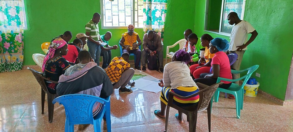
Leading stakeholder capacity building and community consultations.
-
Mapping of land use via GIS and developed draft PLUPs.
-
Facilitating validation workshops and finalising action plans.
-
Promoting community-led zoning for conservation, agriculture, forestry, mining, and other uses.
Results, outcomes to date
-
Completion of PLUPs in 40 areas by July 2023.
-
Empowered communities to apply for land deeds under the Land Rights Act.
-
Identified and mapped high-priority forest zones, including transboundary areas like Gola and Ziama-Wonegizi-Wologizi.
-
Integrated traditional resource management and protection of medicinal plants based on community feedback.
Donors/partners, current and previous funding
The initial funding of the PLUP came from the Norwegian government through the World Bank. Other partners are LLA, MoA, FDA, EPA, IDH, SCNL and FFI.
External links
South East Landscape, Liberia - IDH - the Sustainable Trade Initiative
Categorias: Production Landscape Programmes Iniciativas em escala de paisagem África